
The evolution of Earth observation technology has propelled scientific inquiry and decision-making to unprecedented heights, ushering in an era of unparalleled precision and insight into our planet's dynamics. From the intricate details captured by hyperspectral imaging to the intricate web of data unveiled by Synthetic Aperture Radar (SAR), the possibilities seem boundless. These technological strides not only deepen our comprehension of Earth's intricate systems but also hold the key to unlocking solutions to some of the most pressing global challenges. The horizon of Earth observation technology stretches far and wide, beckoning us to explore its limitless potential for a future shaped by knowledge and innovation.
Key Takeaways
- Hyperspectral Imaging and SAR advancements offer detailed Earth surface data.
- Earth observation applications range from disaster management to resource optimization.
- SAR technology enhancements enable high-resolution, all-weather imaging.
- Future trends predict significant market growth driven by commercialization and AI integration.
Hyperspectral Imaging Overview

Hyperspectral imaging, a cutting-edge technology in remote sensing, involves the capture of images at numerous narrow spectral bands to provide intricate details on the composition of Earth's surface. Unlike multispectral imaging, hyperspectral sensors can capture hundreds of spectral bands, enabling precise identification of materials and vegetation types. This detailed data allows for the analysis of biochemical properties, mineral content, and vegetation health, which significantly enhances environmental monitoring and resource management efforts.
The applications of hyperspectral imaging span various fields such as agriculture, forestry, mineral exploration, and environmental studies. By offering in-depth analysis of Earth's surface characteristics, hyperspectral data plays a crucial role in understanding and managing natural resources effectively. The advancement of hyperspectral imaging technology on satellites like Landsat has revolutionized remote sensing capabilities, providing valuable insights for industries and scientific research.
In environmental monitoring, hyperspectral imaging aids in detecting changes in land cover, identifying pollution sources, and assessing ecosystem health. Resource management benefits from hyperspectral data through improved land-use planning, efficient crop management, and optimized natural resource exploitation. Overall, hyperspectral imaging stands as a powerful tool in Earth observation, offering detailed insights that drive informed decision-making in various sectors.
Benefits of Hyperspectral Imaging
The detailed chemical composition information captured across hundreds of narrow spectral bands by hyperspectral imaging technology offers invaluable insights into Earth's surface characteristics, enabling precise identification of materials and vegetation types. Satellite instruments equipped with hyperspectral capabilities can identify specific plant constituents and detect canopy structural characteristics with high precision. Landsat satellites, renowned for their role in Earth observation, have been pivotal in utilizing hyperspectral data for monitoring land use changes and conducting environmental assessments.
Moreover, hyperspectral imagery provides crucial insights into ecosystem health, enabling the detection of vegetation stress and assessment of soil properties. The advanced spectral resolution of hyperspectral imaging enhances the analysis of Earth's surface composition and ecosystem dynamics. By examining the unique spectral signatures of different materials, hyperspectral imaging aids in mapping out various features on the Earth's surface and understanding the distribution of vegetation types. This technology plays a crucial role in environmental monitoring, resource management, and scientific research by offering detailed information that was previously unattainable through traditional imaging methods.
Applications of Hyperspectral Imaging
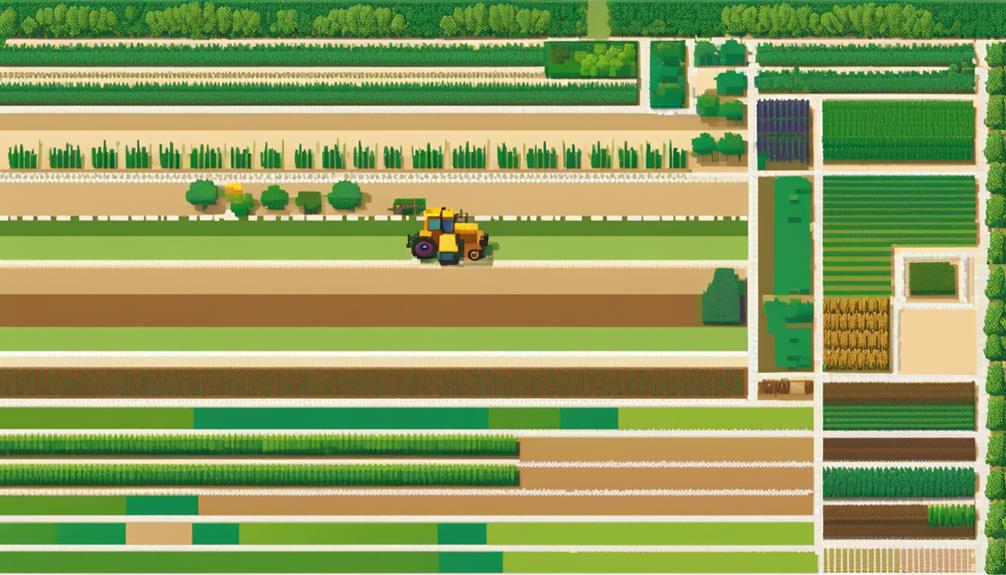
Advancing beyond the realm of basic imaging technologies, hyperspectral imaging offers a multifaceted approach to analyzing Earth's surface characteristics with unparalleled detail and precision. By utilizing hundreds of narrow spectral bands, hyperspectral imaging enables the identification of detailed chemical compositions in the Earth's surface. Satellites equipped with hyperspectral sensors play a crucial role in various applications such as vegetation health monitoring, mineral exploration, and environmental analysis. The data obtained through hyperspectral imaging allows for the detection of subtle changes in land cover, facilitating precision agriculture, forestry management, and urban planning.
| Applications | Description | Benefits |
|---|---|---|
| Vegetation Health Monitoring | Monitoring and assessing the health of vegetation using spectral signatures for early issue detection | Improved crop management and increased agricultural productivity |
| Precision Agriculture | Utilizing hyperspectral data to optimize crop yield, reduce resource wastage, and enhance sustainability | Enhanced decision-making in farming practices for efficient use of resources and environmental conservation |
| Chemical Compositions | Identifying and analyzing specific chemical compositions present in the Earth's surface | Valuable insights for geological studies, environmental monitoring, and resource management |
Hyperspectral imaging plays a vital role in enhancing our understanding of ecosystem dynamics, pollution levels, and natural resource distribution. Its detailed spectral information supports research in crop health assessment, invasive species detection, and habitat mapping with improved accuracy and specificity, making it a valuable tool in various scientific and environmental fields.
Synthetic Aperture Radar (SAR) Introduction
Synthetic Aperture Radar (SAR) is an advanced remote sensing technology that offers a comprehensive view of Earth's surface with high-resolution imaging capabilities. SAR systems utilize microwave signals to generate detailed images regardless of weather conditions, making it a versatile tool for various applications. Understanding SAR Applications Overview, SAR Imaging Capabilities, and SAR Data Interpretation will provide insights into the wide-ranging benefits and uses of this technology in Earth observation.
SAR Applications Overview
Utilizing cutting-edge radar technology, Synthetic Aperture Radar (SAR) offers unparalleled insights into Earth's surface features and dynamics. SAR, a remote sensing technology, provides high-resolution images of the Earth's surface, enabling various applications such as disaster response and terrain analysis. Key points to note about SAR applications include:
- SAR satellites can capture images day or night, through clouds, and even in adverse weather conditions.
- SAR technology allows for 3D mapping, terrain analysis, and monitoring of changes in Earth's surface over time.
- SAR applications extend to disaster response, agriculture monitoring, urban planning, and defense intelligence.
- SAR data is valuable for detecting oil spills, monitoring sea ice, measuring land deformation, and assessing forest biomass.
SAR Imaging Capabilities
Building upon the foundational understanding of SAR applications, the introduction of Synthetic Aperture Radar (SAR) imaging capabilities revolutionizes the field of remote sensing by providing unparalleled insights into Earth's surface features with high-resolution radar imagery. SAR, a remote sensing technology, offers all-weather imaging capabilities, allowing for continuous monitoring regardless of environmental conditions. This feature is particularly valuable for disaster monitoring and surveillance applications where immediate and accurate information is crucial. Moreover, SAR technology enables precise measurements of ground deformation, making it essential for monitoring natural hazards such as earthquakes and landslides. The high-resolution images produced by SAR satellites are instrumental in analyzing terrain, monitoring vegetation, and detecting changes in infrastructure, supporting a wide range of applications in agriculture, forestry, and urban planning.
SAR Data Interpretation
The analysis of Synthetic Aperture Radar (SAR) data plays a pivotal role in extracting valuable insights from high-resolution radar imagery of Earth's surface.
- SAR data interpretation involves analyzing radar images to identify features and map surface characteristics.
- It is crucial for environmental monitoring and disaster management.
- SAR enables all-weather imaging capabilities, allowing for continuous surveillance.
- The technology aids in monitoring natural disasters and changes over time.
- SAR data interpretation is instrumental in applications such as agriculture, forestry, and urban planning.
SAR Technology Advancements
Advancements in SAR technology have significantly enhanced resolution capabilities, enabling the capture of detailed imagery with unprecedented clarity. Additionally, improvements in data processing techniques have streamlined the extraction of valuable information from SAR data, contributing to more efficient analysis and interpretation. These developments in SAR technology pave the way for more precise mapping, monitoring, and detection applications across various industries.
Improved Resolution Capabilities
Enhancing satellite imaging capabilities, Synthetic Aperture Radar (SAR) technology advancements have revolutionized high-resolution Earth observation with pixel sizes reaching as small as 1 meter. This improvement in SAR technology has significantly enhanced disaster monitoring and environmental assessment capabilities. Key features include:
- All-weather, day-and-night imaging capabilities
- Detection of small surface changes
- Penetration through clouds, vegetation, and soil
- Detailed insights into terrain topography and land cover
- Monitoring of ground deformation with millimeter-level precision
These advancements allow for precise assessment of geological hazards and infrastructure stability, making SAR an invaluable tool in modern Earth observation.
Enhanced Data Processing
Building upon the enhanced resolution capabilities of Synthetic Aperture Radar (SAR) technology, the focus now shifts towards optimizing data processing techniques to further leverage the potential of high-resolution Earth observation data. SAR technology advancements have enabled high-resolution imaging capabilities from space, utilizing radar signals to create detailed images irrespective of weather conditions or daylight. This technology plays a crucial role in disaster monitoring, land deformation analysis, and maritime surveillance. Advancements in SAR technology encompass higher resolution, shorter revisit times, and improved data processing methods. These developments are essential for applications such as mapping terrain, monitoring infrastructure, and detecting changes in urban areas. Enhanced data processing techniques in SAR technology enhance the efficiency and accuracy of analyzing Earth's surface for various purposes.
SAR in Disaster Response

The utilization of Synthetic Aperture Radar (SAR) technology plays a crucial role in disaster response by providing all-weather, day-and-night imaging capabilities. SAR in disaster response is a powerful tool that enhances emergency management efforts through its unique capabilities. Here are some key points highlighting the significance of SAR in disaster response:
- SAR satellites can detect ground deformation, landslides, and structural damage in disaster-affected areas with high accuracy.
- SAR data aids in assessing post-disaster situations, enabling rapid response and effective decision-making for emergency management.
- SAR technology offers valuable insights for monitoring flood extents, assessing infrastructure damage, and supporting search and rescue operations.
- SAR imagery can be used to map flood patterns, monitor volcanic activity, and assess the impact of earthquakes, enhancing disaster response efforts.
The ability of SAR technology to provide detailed and timely information regardless of weather conditions makes it an invaluable asset in disaster response scenarios. By leveraging SAR data, response teams can better understand the extent of a disaster, assess the damage caused, and prioritize their actions for efficient and effective emergency management.
Advantages of SAR
An essential component of Earth observation technology, Synthetic Aperture Radar (SAR) offers a multitude of advantages due to its all-weather imaging capabilities and high-resolution data acquisition. SAR technology's ability to operate regardless of weather conditions and lighting enables continuous monitoring of Earth's surface. SAR sensors onboard satellites can capture detailed information on surface structures, making it a valuable tool for various applications.
One significant advantage of SAR is its role in monitoring land cover changes. By analyzing SAR data, researchers can track deforestation, urban expansion, and other alterations in land use over time. Furthermore, SAR plays a crucial role in geohazard monitoring by providing precise measurements of ground deformation. This capability is instrumental in assessing potential risks, ensuring infrastructure stability, and early warning systems for natural disasters.
The all-weather imaging capability of SAR is particularly beneficial for consistent monitoring in challenging environments. SAR's ability to penetrate clouds and vegetation allows for the reliable observation of landscapes, even in adverse weather conditions. This feature makes SAR technology indispensable for a wide range of applications in Earth observation, from environmental monitoring to disaster management and infrastructure planning.
Integration of SAR and Hyperspectral Imaging
Enhancing Earth observation capabilities, the integration of SAR and hyperspectral imaging combines radar's penetration strengths with detailed spectral information for comprehensive surface analysis. This integration offers a powerful solution for a wide range of applications in Earth observation, particularly in analyzing surface characteristics and optimizing resource management strategies.
Key Points:
- SAR Technology: SAR technology, known for its all-weather imaging capabilities, allows for monitoring surface deformation, terrain mapping, and rapid disaster response.
- Hyperspectral Imaging: Hyperspectral imaging sensors capture data across numerous spectral bands, aiding in detailed material identification, environmental monitoring, vegetation analysis, and mineral exploration.
- Enhanced Capabilities: By integrating SAR and hyperspectral imaging, Earth observation benefits from the synergistic combination of penetration capabilities and detailed spectral information.
- Comprehensive Insights: The combined datasets offer in-depth analysis of Earth's surface characteristics, leading to improved accuracy in land cover classification, change detection, and resource management applications.
- Optimized Resource Management: This integration enables better decision-making in resource management by providing a holistic view of surface conditions and facilitating efficient utilization of natural resources.
The merging of SAR and hyperspectral imaging technologies holds immense potential for advancing Earth observation capabilities, offering a more holistic and detailed understanding of our planet's surface features and dynamics.
Future Trends in Earth Observation
Integrating cutting-edge technologies such as SAR, Hyperspectral, Edge Computing in Space, and Thermal Infrared is shaping the future landscape of Earth observation, driving innovation and unlocking new possibilities for comprehensive data analysis and insights. Future trends in Earth observation point towards a significant growth trajectory, with the Earth observation data and service market projected to reach US$8 billion by 2032. The commercialization of space is a key driver of this growth, with companies increasingly adopting a strategic asset view and engaging in backward vertical integration within the sector.
Moreover, the adoption of machine learning algorithms is revolutionizing Earth observation data analysis, enabling more efficient processing and extraction of valuable insights. Application sectors such as carbon monitoring, parametric insurance, and climate risk reporting are witnessing increased adoption of Earth observation technologies, highlighting the diverse range of benefits these advancements offer. Private investment in the commercial space sector, particularly in Europe, is on the rise, with the region accounting for 37% of global private investment in Earth observation in 2022.
As technology continues to evolve and capabilities expand, the future of Earth observation holds immense potential for driving sustainability, innovation, and informed decision-making across various industries and sectors.
Industry Applications of Earth Observation
Harnessing the power of advanced Earth observation technologies, industries are increasingly utilizing data insights for a myriad of applications ranging from climate change mitigation to sustainable agriculture and disaster management. The Earth observation industry is witnessing a significant shift towards leveraging satellite data and cutting-edge technologies to address various challenges and optimize resources efficiently. Here are some key industry applications of Earth observation:
- Disaster Management: Satellite data is instrumental in providing real-time information for disaster preparedness, response, and recovery efforts.
- Climate Change Mitigation: Earth observation technologies play a crucial role in monitoring environmental changes, tracking greenhouse gas emissions, and assessing the impact of climate policies.
- Resource Optimization: Industries are using Earth observation data for optimizing resource management practices, such as water usage, land allocation, and energy consumption.
- Applications Development: The Earth observation industry is witnessing a surge in applications development, including carbon monitoring, parametric insurance, and climate risk reporting.
- Partnerships and Collaborations: Strategic partnerships between satellite providers and industries in sectors like energy, finance, insurance, and agriculture are driving innovation and expanding the use of Earth observation data for diverse applications.
These applications highlight the growing importance of Earth observation technology in enabling industries to make informed decisions, enhance sustainability practices, and mitigate risks effectively.
Environmental Monitoring With Earth Observation
Earth observation technology facilitates comprehensive monitoring of environmental changes, including deforestation, urban expansion, and pollution levels, through the utilization of satellite data and remote sensing technology. Satellites play a crucial role in providing essential data for tracking climate change indicators such as sea surface temperatures, ice melt, and greenhouse gas emissions. This information is vital for understanding the impact of human activities on the environment and for formulating effective mitigation strategies. Moreover, Earth observation data enables the assessment of natural disasters like wildfires, floods, hurricanes, and earthquakes, allowing for timely response and better disaster management.
To better illustrate the significance of environmental monitoring with Earth observation, the following table outlines key aspects:
| Aspect | Description | Importance |
|---|---|---|
| Biodiversity Monitoring | Tracking changes in species diversity and habitats | Conservation efforts |
| Pollution Levels | Monitoring air, water, and soil pollution levels | Public health and environmental protection |
| Land Cover Changes | Assessing alterations in land use and vegetation cover | Sustainable resource management |
| Climate Change Indicators | Tracking indicators like temperature and sea levels | Mitigation strategies for climate change |
The Earth Observation Market continues to expand, driven by the demand for accurate environmental data to support decision-making processes and address global environmental challenges. The integration of advanced technologies like AI and machine learning further enhances the analysis of Earth observation data, ensuring greater accuracy and efficiency in environmental monitoring efforts.
Research Opportunities in Earth Observation

Research opportunities in Earth Observation encompass utilizing advanced data analysis techniques to explore trends in climate change impacts on ecosystems. Remote sensing applications offer the potential to monitor deforestation patterns and biodiversity loss at a global scale. Additionally, focusing on climate change monitoring through assessing land surface temperature changes using satellite data presents a significant avenue for research in this field.
Data Analysis Techniques
The evolution of data analysis techniques within Earth Observation presents promising avenues for advancing knowledge and decision-making capabilities in various sectors.
- Machine learning algorithms enhance data processing by automating insights extraction from satellite imagery.
- Integration of AI/ML enables automated processing, improving accuracy and speed in analyzing EO data.
- AI/ML algorithms detect changes, classify surface features, and provide insights in agriculture, forestry, and urban planning.
- Applications include land cover classification, disaster monitoring, and deforestation detection for informed decision-making.
- Advancements in data analysis techniques with AI/ML in Earth Observation unlock new insights across sectors.
Remote Sensing Applications
Advancements in data analysis techniques leveraging remote sensing technologies have opened up new research opportunities in Earth Observation, particularly in monitoring natural disasters, resources, and environmental changes. Satellites play a crucial role in capturing geospatial data that aids in environmental monitoring and disaster management. Researchers utilize machine learning algorithms to process vast amounts of data acquired through remote sensing, enabling the identification of patterns and trends in Earth's dynamics. These insights support informed decision-making in various fields, from urban planning to agriculture. Systems like the Copernicus program provide researchers with open-access data, fostering scientific studies on global environmental changes. Remote sensing applications, facilitated by satellites and drones, continue to enhance our understanding of the Earth's ecosystems and assist in addressing pressing challenges related to natural disasters and resource management.
Climate Change Monitoring
Earth observation technology plays a pivotal role in monitoring climate change indicators, such as temperature trends, sea level rise, and ice melt patterns, providing crucial insights into the evolving dynamics of our planet.
- Satellite data provides global coverage for tracking changes in greenhouse gas concentrations and their impact on climate.
- Remote sensing tools help scientists study the effects of climate change on ecosystems, weather patterns, and natural disasters.
- Earth observation data aids in assessing environmental impacts of climate change, such as deforestation, desertification, and coral reef degradation.
- Continuous monitoring through satellite observations supports climate research, policy-making, and strategies for climate change mitigation and adaptation.
Frequently Asked Questions
What Are Earth Observation Technologies?
Earth observation technologies encompass a range of satellite-based sensors that collect data on Earth's surface. These sensors provide crucial information for climate monitoring, disaster management, urban planning, agricultural surveillance, biodiversity tracking, and ocean monitoring. By capturing data through optical, radar, and hyperspectral sensors, these technologies offer valuable insights into environmental changes and aid in resource management. The data collected supports various applications, including land use planning and disaster response efforts.
What Are the Advancements in Satellite Technology?
Advancements in satellite technology have significantly improved satellite resolution, enabling sharper and more detailed imaging of Earth's surface. Innovations in hyperspectral imaging provide enhanced spectral information for various applications. Synthetic aperture radar (SAR) technology offers precise radar imaging capabilities for accurate monitoring. Integration of machine learning algorithms enhances data analysis processes. Techniques like atmospheric correction and radiometric calibration further refine satellite data for improved accuracy and reliability in Earth observation.
What Are the Recent Trends in Remote Sensing Earth Observation Data?
Recent trends in remote sensing earth observation data include advancements in data analytics for improved processing and interpretation. Precision agriculture benefits from satellite data for crop monitoring and management. Climate monitoring utilizes remote sensing to track environmental changes accurately. Urban planning benefits from detailed satellite imagery for infrastructure development. Disaster management leverages satellite data for early warning systems. Biodiversity conservation efforts are enhanced through the use of remote sensing technology for habitat monitoring and protection.
What Are the Applications of Earth Observation Satellites?
Earth observation satellites play a pivotal role in various sectors. They aid in environmental monitoring, disaster management, agriculture optimization, urban planning, climate change mitigation, biodiversity preservation, land use analysis, water resource management, natural hazard assessment, deforestation tracking, infrastructure development, and wildlife conservation. These satellites provide crucial data for decision-making processes, enabling effective responses to emergencies, sustainable resource management, and strategic planning across diverse fields.