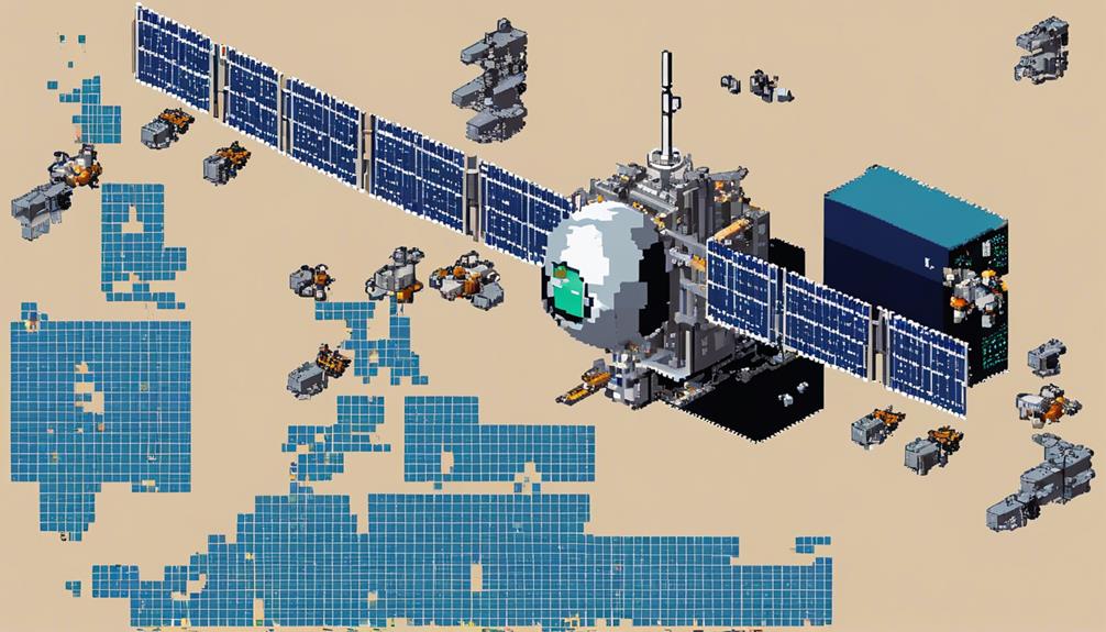
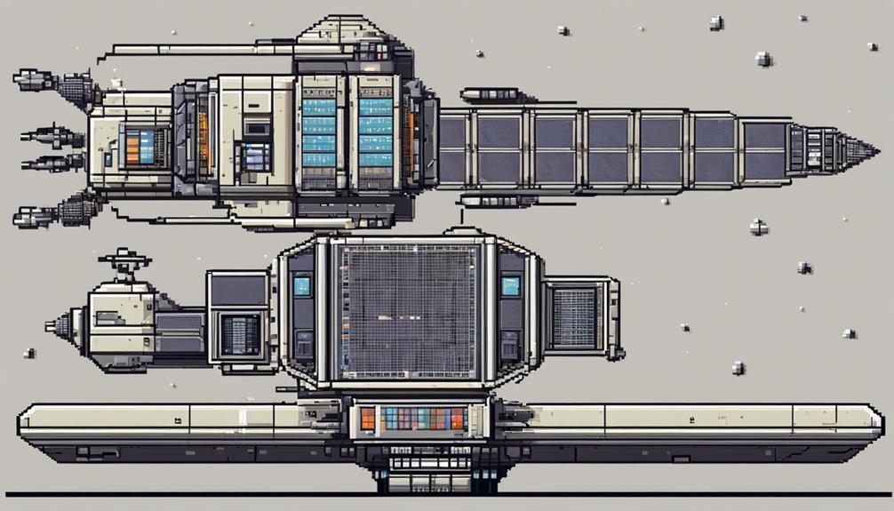
Payloads in satellites play a fundamental role in the successful operation of these complex systems, encompassing a variety of types with distinct functions. From communication to observation and navigation, each payload serves a specific purpose critical to the satellite's mission. Understanding the intricacies of these payloads is essential not only for satellite engineers but also for individuals interested in the advancements driving space exploration. By unraveling the layers of payloads within satellites, a deeper appreciation for the sophistication and significance of satellite technology emerges, shedding light on the untapped potential and possibilities that lie within these orbiting marvels.
Key Takeaways
- Satellite payloads encompass imaging sensors, radar systems, lidar technology, and scientific instruments for data collection and analysis.
- Instrument calibration ensures precise measurements, consistency, and reliability crucial for groundbreaking discoveries and research.
- Satellite communication and navigation systems facilitate connectivity, accurate positioning, and data exchange for enhanced satellite operations.
- Commercial satellite services offer broadcasting, internet access, climate change studies, and advanced communication technologies for diverse applications.
Imaging Sensors in Satellites

Utilizing advanced imaging sensors in satellites enables the acquisition of high-resolution data crucial for a multitude of Earth-centric applications. These spacecraft payloads, which can be optical, radar, or lidar-based, play a pivotal role in Earth observation and environmental monitoring.
Optical sensors are fundamental components of satellite imaging systems, utilizing visible or infrared light to capture detailed images of Earth's surface. By detecting variations in light intensity, these sensors can distinguish between different land covers, monitor vegetation health, and even identify urban development patterns. Optical sensors are particularly useful for tasks requiring visual clarity and color differentiation, such as crop monitoring or urban planning.
On the other hand, radar sensors offer a unique imaging capability by being able to penetrate clouds and darkness. This feature allows radar-equipped satellites to acquire data regardless of weather conditions or time of day, making them invaluable for disaster response and persistent environmental monitoring. Radar sensors can detect surface roughness, map terrain features, and even monitor changes in sea ice extent, providing critical information for various scientific and practical applications.
Similarly, lidar sensors, which use laser pulses to measure distances, offer unparalleled precision in creating 3D maps of terrain or structures. By emitting laser beams and analyzing the reflected light, lidar sensors can generate highly detailed elevation models, detect subtle landscape changes, and support tasks like flood modeling or forest inventory assessments.
Scientific Instruments on Board
Satellites are equipped with a variety of scientific instruments such as telescopes, spectrometers, and sensors for data collection. These instruments play a crucial role in conducting experiments and acquiring important data regarding celestial bodies. Moreover, scientific payloads undergo meticulous calibration processes to ensure accurate data analysis and enhance the understanding of the universe.
Instrumentation for Data
Deploying advanced scientific instrumentation on satellites is crucial for enhancing our comprehension of the universe. Scientific instruments onboard satellites, such as telescopes, spectrometers, and sensors, play a vital role in collecting data on celestial bodies, surface features, and various space phenomena. These instruments enable researchers to conduct experiments and gather valuable scientific information essential for space exploration and research. By studying celestial bodies and their characteristics, satellite-based scientific instruments contribute significantly to missions aimed at understanding the universe better. They aid in analyzing surface features, monitoring changes in space environments, and conducting in-depth research on a wide range of celestial phenomena, thus advancing our knowledge and exploration capabilities in space.
Analysis of Collected Data
Enhancing our understanding of the universe relies heavily on the meticulous analysis of data collected by the scientific instruments equipped on satellites. Scientific observation tools such as telescopes and spectrometers play a crucial role in gathering data on celestial bodies and space phenomena. The collected data, including information on atmospheric compositions, surface features, and space environments, is essential for research and advancements in astronomy. Utilizing analysis tools like cameras, radars, and spectrometers, scientists can extract valuable insights from the vast amount of data collected by these instruments. This data aids in studying the characteristics of various celestial bodies, contributing significantly to our knowledge of the universe and its complex dynamics.
Instrument Calibration Processes
Calibrating scientific instruments on board satellites is a meticulous process crucial for ensuring the accuracy and reliability of data collected from space observations.
3 Reasons Why Instrument Calibration is Vital:
- Precision: Calibration adjusts instrument settings to match known reference standards, ensuring accurate measurements.
- Consistency: Regular calibrations are essential to account for environmental factors and maintain instrument performance in space.
- Data Quality: Calibrated instruments provide high-quality data crucial for scientific research and analysis conducted using satellite observations.
Through rigorous calibration procedures, satellites can consistently deliver precise and reliable data, enabling groundbreaking discoveries and advancements in various scientific fields.
Communication Devices for Connectivity
Communication devices in satellite payloads encompass a range of equipment, including transmitters, receivers, and antennas, designed to establish robust connectivity. These devices are fundamental for enabling signal transmission methods and data transfer technologies essential for communication purposes. Operated across various frequency bands, they form the backbone of communication subsystems vital for seamless global connectivity.
Signal Transmission Methods
Utilizing a diverse array of modulation techniques such as amplitude modulation (AM), frequency modulation (FM), and phase modulation (PM), communication devices on satellites establish crucial connectivity with ground stations. Signal transmission methods play a pivotal role in ensuring reliable communication links between space systems and Earth. Key components like transponders receive radio signals from Earth, amplify them using onboard amplifiers, and retransmit the signals back to designated areas. These methods are essential for maintaining effective communication between satellites and ground stations, enabling seamless data exchange and information dissemination. Advanced communication devices on satellites support multiple frequency bands and signal coding schemes, enhancing the efficiency and robustness of signal transmission in various conditions.
Emotional Numeric List:
- Cutting-edge modulation techniques revolutionize satellite communication.
- Transponders amplify the heartbeat of connectivity between space and Earth.
- Advanced amplifiers power the pulse of information flow in the vast void of space.
Data Transfer Technologies
Deploying cutting-edge communication devices in satellites ensures seamless connectivity for data transfer between space systems and ground stations. Communication devices such as transponders, antennas, receivers, and transmitters play a vital role in facilitating efficient data transfer. These devices enable the satellite to transmit and receive signals, allowing for various communication services like telecommunication, broadcasting, and internet connectivity. Satellites utilize sophisticated radio technologies to ensure reliable data transfer over vast distances. The integration of these communication devices is crucial for the successful operation of satellite payloads, ensuring uninterrupted connectivity. Below is a table highlighting the key communication devices used in satellites:
| Communication Devices | Functions | Usage |
|---|---|---|
| Transponders | Signal conversion | Data transmission and reception |
| Antennas | Signal reception | Establishing communication links |
| Receivers | Signal processing | Receiving data from ground stations |
Weather Forecasting Capabilities
Satellites equipped with weather forecasting payloads employ specialized instruments like radiometers, spectrometers, and sounders to collect crucial data on atmospheric conditions. These payloads play a vital role in enhancing our understanding of weather patterns and improving the accuracy of weather predictions. Here are three key points highlighting the significance of weather forecasting capabilities on satellites:
- Enhanced Prediction Accuracy: Weather forecasting payloads onboard satellites gather essential data such as temperature, humidity, cloud cover, and precipitation. By analyzing these parameters, meteorologists can create more precise forecasts, helping communities better prepare for upcoming weather events.
- Monitoring Severe Weather Events: Satellite-based weather payloads are instrumental in monitoring severe weather events like hurricanes, typhoons, and cyclones from space. This capability allows for early detection and tracking of these events, enabling timely warnings and potentially saving lives.
- Real-Time Imagery for Climate Monitoring: Advanced weather satellites equipped with sophisticated payloads provide real-time imagery and data for monitoring climate changes, natural disasters, and environmental conditions. This data is invaluable for researchers and policymakers looking to understand the impact of climate change and make informed decisions.
Earth Observation and Monitoring
Earth observation and monitoring involve the use of advanced imaging technologies for capturing data about the Earth's surface and atmosphere. These technologies enable remote sensing applications that aid in environmental data collection and analysis. By utilizing Earth observation payloads, satellites can provide valuable insights for various fields such as agriculture, urban planning, and disaster management.
Imaging Technologies for Earth
Utilizing advanced imaging technologies such as cameras, radar, and lidar, Earth observation payloads gather crucial data on the Earth's surface features for a wide range of applications. These imaging technologies on satellites operate in varying lighting conditions, including day and night, enabling continuous monitoring of the Earth. Earth observation instruments leverage multi-spectral and hyper-spectral imaging capabilities to study land use, vegetation health, and atmospheric conditions. The data collected by these remote sensing instruments are instrumental in environmental monitoring, disaster management, agriculture, and urban planning. Earth observation payloads play a pivotal role in monitoring climate change, natural disasters, and human activities on a global scale.
Emotional Numeric List:
- Astonishingly detailed images reveal Earth's beauty from above.
- Cutting-edge technology aids in safeguarding our planet's future.
- Continuous monitoring provides a vigilant eye on Earth's changes.
Remote Sensing Applications
Leveraging advanced remote sensing technologies, the monitoring and analysis of Earth's surface features through satellite-based payloads play a critical role in a wide array of applications, including environmental monitoring, disaster management, agriculture, and urban planning. Earth observation payloads on satellites use cameras, radar, and lidar to collect data for studying climate change, natural disasters, deforestation, and land use patterns. These tools enable continuous monitoring of oceans, forests, urban areas, and other regions, supporting scientific research and decision-making. The gathered data aids in weather forecasting, resource management, and infrastructure development. Below is a table showcasing the key applications of remote sensing in Earth observation:
| Application | Description | Tools Used |
|---|---|---|
| Environmental Monitoring | Monitoring changes in the environment for conservation efforts | Cameras, radar, lidar |
| Disaster Management | Early detection and response to natural disasters | Radar, cameras |
| Agriculture | Assessing crop health and optimizing farming practices | Cameras, lidar |
Environmental Data Collection
Satellite payloads dedicated to environmental data collection play a pivotal role in monitoring and analyzing various aspects of Earth's ecosystem from a vantage point in space. Earth observation payloads collect crucial data on environmental conditions, weather patterns, and natural disasters, aiding in disaster response and climate studies globally. These payloads also monitor changes in land use, vegetation health, and water resources, providing valuable insights into air quality, pollution levels, and climate change impacts. Satellite-based monitoring enables continuous data collection for sustainable resource management, supporting conservation efforts and informed decision-making by scientists and policymakers. Through the lens of Earth observation, the intricate web of our planet's interconnected systems becomes clearer, emphasizing the importance of satellite technology in understanding and protecting our environment.
- Earth observation payloads offer a bird's eye view of our changing planet.
- Satellite data aids in disaster response and climate research, shaping a more resilient future.
- Sustainable resource management benefits from the wealth of information provided by satellite-based monitoring.
Remote Sensing Applications
Remote sensing applications on satellites play a crucial role in capturing detailed data about Earth's surface, atmosphere, and oceans through the use of advanced sensors like cameras, radar, and lidar. These remote sensing payloads aid in various applications such as monitoring climate change, natural disasters, agriculture, and urban development. By utilizing remote sensing technology, satellites can provide global coverage and frequent data acquisition, enabling timely analysis of Earth's dynamic systems.
The table below highlights some key remote sensing applications on satellites:
| Application | Description | Example |
|---|---|---|
| Climate Monitoring | Utilizing sensors to observe and analyze changes in temperature, precipitation, and greenhouse gas concentrations. | Tracking sea surface temperatures to predict hurricane formation. |
| Disaster Management | Providing real-time data to assess the impact of disasters like floods, wildfires, and earthquakes for effective response planning. | Mapping flood extents to guide emergency evacuation efforts. |
| Agricultural Mapping | Monitoring crop health, soil moisture levels, and land use patterns to optimize farming practices and ensure food security. | Identifying areas with water stress to apply targeted irrigation. |
| Urban Planning | Surveying urban areas to monitor population growth, infrastructure development, and land use changes for sustainable city planning. | Analyzing urban sprawl to address transportation and housing needs. |
| Environmental Study | Studying ecosystems, biodiversity, and natural resources to support conservation efforts and sustainable resource management. | Assessing deforestation rates in tropical regions to combat illegal logging. |
These applications demonstrate the diverse capabilities of remote sensing payloads on satellites in collecting valuable data for monitoring and analysis purposes.
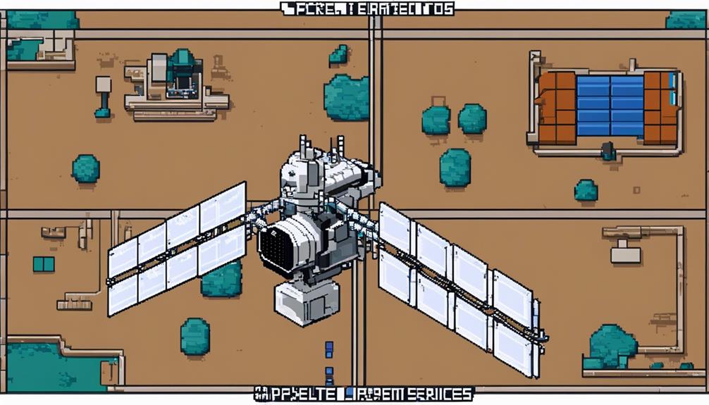
GPS and Navigation Systems

The integration of GPS and navigation systems within satellite payloads is paramount in ensuring precise positioning and timing services for a variety of applications, building on the advancements in remote sensing technologies. These systems play a crucial role in enhancing the accuracy and efficiency of satellite operations, particularly in regional contexts. Here are three key points to consider:
- IRNSS – Enhancing Regional Navigation: The Indian Regional Navigation Satellite System (IRNSS), now known as NAVIC, is designed to provide precise position accuracy better than 20 meters over India and surrounding regions. By incorporating navigation payloads in a combination of Geostationary Earth Orbit (GEO) and Geosynchronous Orbit (GSO) spacecraft, the IRNSS aims to establish a robust regional navigation system that caters to the specific positioning needs of the area.
- Accurate Positioning and Timing Services: Navigation payloads integrated into IRNSS spacecraft are instrumental in supporting accurate positioning and timing services. By leveraging both geostationary and geosynchronous satellites, the NAVIC system can significantly enhance regional navigation capabilities, ensuring that users have access to reliable and real-time positioning information.
- Critical Role in Various Applications: The navigation payloads on IRNSS spacecraft play a pivotal role in providing precise positioning information for a wide range of applications. Whether it is for transportation, disaster management, agriculture, or telecommunications, the accurate data obtained from these satellites is invaluable in optimizing operations and decision-making processes.
Space Exploration Missions
Deploying sophisticated scientific payloads, space exploration missions are pivotal in advancing our understanding of the universe through data collection and experimental analysis in the unique environment of space. These missions play a significant role in studying celestial bodies and phenomena, utilizing advanced instruments like telescopes and spectrometers. The scientific payloads onboard exploration missions enable the study of planets, moons, asteroids, and other celestial objects, contributing to the accumulation of new scientific insights and knowledge.
To provide a clearer overview of the importance of scientific payloads in space exploration missions, the table below outlines key aspects of their role:
| Aspect | Description | Importance |
|---|---|---|
| Data Collection | Scientific payloads gather valuable data on celestial bodies, aiding in research and analysis. | Crucial for research outcomes |
| Experimental Analysis | Payloads conduct experiments in the space environment, allowing for unique scientific observations. | Enables scientific discoveries |
| Instrumentation | Advanced instruments like telescopes and spectrometers help in studying various celestial objects. | Essential for mission success |
Disaster Response and Management
Satellite payloads are integral in disaster response and management, providing essential tools for emergency situations. From facilitating communication during emergencies to utilizing remote sensing for aid, satellite payloads offer crucial support in crisis scenarios. The coordination and data provided by these payloads play a vital role in ensuring efficient and effective disaster response efforts.
Satellite Communication for Emergencies
In times of crisis, how do satellite communication systems serve as indispensable tools for ensuring effective disaster response and management? Satellite communication systems are crucial during emergencies due to their resilience and reliability. Here are three key ways they aid in disaster management:
- Quick Coordination: Satellite systems enable rapid coordination of rescue efforts and the dissemination of critical information to response teams on the ground.
- Continuous Communication: They provide uninterrupted communication links, essential for reaching affected areas where traditional infrastructure may be compromised.
- Enhanced Decision-Making: Satellite technology enhances situational awareness, facilitates real-time data exchange, and supports efficient resource allocation for improved disaster response and management.
Remote Sensing for Aid
During disaster response and management, the utilization of remote sensing technologies plays a pivotal role in providing crucial real-time data on affected regions, aiding in damage assessment, hazard identification, and tactical planning for rescue operations. Satellite imagery, a key component of remote sensing, assists in assessing the extent of damage caused by natural disasters like floods, wildfires, and earthquakes. By monitoring these events from space, remote sensing technology enables authorities to make informed decisions and allocate resources efficiently for disaster management. This proactive approach facilitated by remote sensing not only reduces response time but also contributes significantly to saving lives during emergencies. The ability to gather and analyze real-time data enhances the effectiveness of disaster response efforts by ensuring swift and targeted actions.
Coordination in Crisis
Efficient crisis coordination relies heavily on the seamless integration of satellite payloads to facilitate real-time data delivery and support strategic decision-making in disaster response and management scenarios. Satellite payloads aid in coordinating emergency services, supply distribution, and evacuation efforts during crises. Here are three ways satellite payloads enhance crisis coordination:
- Real-time Data: Satellite payloads provide critical real-time data and imagery for assessing and responding to disasters promptly.
- Communication Networks: Satellite communication payloads support seamless communication networks, enabling effective coordination among disaster response teams.
- Monitoring and Analysis: Payloads on satellites play a crucial role in monitoring, analyzing, and guiding scientific and strategic crisis management efforts on the ground.
Agricultural Monitoring and Analysis
Utilizing advanced sensors onboard satellites, agricultural monitoring and analysis payloads efficiently gather crucial data on crop health, soil conditions, and environmental factors for informed decision-making by farmers. These payloads play a vital role in providing real-time information to farmers, enabling them to make well-informed decisions regarding irrigation, fertilization, and pest control. By utilizing satellite-based agricultural monitoring, the need for manual field inspections is reduced, allowing for large-scale crop analysis and management.
The data collected by these payloads not only aids in improving crop yield but also in optimizing resource usage and supporting sustainable farming practices. Integration of advanced technologies such as multispectral imaging and data analytics enhances the capabilities of agricultural monitoring payloads, enabling detailed crop assessment and monitoring. This data-driven approach facilitates the adoption of precision agriculture techniques, leading to more efficient and environmentally friendly farming practices.
Climate Change Studies
Satellite payloads dedicated to climate change studies play a pivotal role in monitoring and analyzing critical Earth climate parameters to enhance scientific understanding and predict the impacts of environmental changes accurately. These payloads equipped with specialized sensors and instruments contribute significantly to environmental monitoring and climate research by tracking key indicators such as temperature variations, ice cover extent, and sea level rise. Moreover, they enable the observation of greenhouse gas emissions, deforestation rates, and ocean acidification levels crucial for climate models development.
Key Benefits of Climate Change Studies using Satellite Payloads:
- Global Coverage: Satellite payloads offer continuous and comprehensive coverage, allowing for the monitoring of environmental changes worldwide in real-time.
- Data Precision: The data collected by these payloads provide high-resolution and precise information on various climate parameters, aiding in detailed analysis and modeling.
- Impact Prediction: By leveraging the data from Earth observation payloads on satellites, scientists can better understand the effects of climate change on glaciers, forests, and coastal regions, facilitating more accurate predictions of future impacts.
Military and Defense Applications
In the realm of military and defense applications, satellite payloads serve indispensable functions, facilitating secure communication, reconnaissance missions, and intelligence gathering with advanced imaging capabilities. Military and defense satellites are equipped with specialized payloads designed to support a range of critical missions. These spacecraft play a pivotal role in ensuring secure and encrypted communication channels for military operations, utilizing advanced technologies to transmit and receive radio signals securely. Moreover, military payloads enable reconnaissance and surveillance missions by incorporating remote sensing capabilities that provide real-time data for strategic decision-making.
One of the primary functions of military payloads is to enhance intelligence gathering through high-resolution imaging systems. These payloads enable military satellites to capture detailed images of specific areas of interest, supporting military analysts in obtaining valuable information for various defense purposes. Additionally, military payloads may include electronic warfare systems designed for countermeasures and defense against potential threats.
Furthermore, secure data transmission is a key feature of military satellite payloads, ensuring that sensitive information is disseminated in real-time to authorized personnel while maintaining confidentiality. The integration of advanced communication technologies within military payloads enhances the overall effectiveness of military and defense missions, making satellite payloads indispensable assets in modern warfare scenarios.
Satellite Internet Provision
The deployment of communication satellites for internet provision revolutionizes global connectivity by leveraging advanced satellite constellations to bridge gaps in broadband access. Satellite internet provision involves sending and receiving data through communication satellites positioned either in geostationary orbit or low Earth orbit. Here is an analysis of this transformative technology:
- Digital Divide: Satellite internet can play a crucial role in bridging the digital divide by providing high-speed internet coverage to rural and remote areas where traditional broadband infrastructure is lacking. This ensures that individuals in underserved regions have access to essential online services and opportunities.
- Latency Challenges: One of the primary challenges faced in satellite internet provision is latency. This delay occurs due to the signal travel distance between Earth and satellites in orbit. Efforts are ongoing to mitigate latency issues and improve the overall user experience of satellite internet services.
- Technological Advancements: Advances in satellite technology are continuously enhancing data speeds and reducing costs associated with satellite internet services. These improvements make satellite internet a more viable and competitive option for users worldwide, contributing to a more connected global community.
Commercial Satellite Services
Facilitating global communication networks and data transmission, commercial satellite services encompass a range of essential functions including broadcasting, internet connectivity, and telecommunication services. Satellite operators play a pivotal role in providing these services by leasing transponders on satellites stationed in geostationary orbits or low Earth orbits. These operators are responsible for enabling activities such as broadcasting television channels and facilitating broadband internet access for users across the globe.
A key aspect of commercial satellite services is their contribution to data transmission through the utilization of microwave and millimeter-wave-based technology. These high-frequency signals allow for efficient communication between ground stations and satellites, enabling seamless connectivity for various applications. Companies like SES, Intelsat, and Eutelsat are prominent players in the commercial satellite services sector, offering a wide array of solutions to meet the growing demands of global communication networks.
To provide a clearer overview of the commercial satellite services landscape, the following table outlines some of the primary functions and features associated with these services:
| Aspect | Description |
|---|---|
| Broadcasting | Satellite operators lease transponders to broadcast television channels. |
| Internet Connectivity | Companies provide broadband internet services through satellite connections. |
| Telecommunication | Facilitating voice calls and data transfer services globally. |
| Data Transmission | Utilizing microwave and millimeter-wave-based science for efficient communication. |
Frequently Asked Questions
What Are the Different Types of Payloads in Rockets?
Various payloads in rockets serve diverse functions, including communication satellites for global connectivity, scientific instruments for data collection, navigation systems for accurate positioning, remote sensing for research, weather forecasting, imaging payloads for capturing imagery, and surveillance technology. Each payload plays a crucial role in enhancing the capabilities of rockets for different purposes, showcasing the advancements in technology and the vast applications of rocket payloads in various industries.
What Is the Function of Payload?
The function of a payload is pivotal in satellite missions, serving as the core component responsible for executing specific tasks vital to the mission's success. Payloads encompass a range of components tailored to the mission's requirements, such as communication antennas, receivers, scientific instruments, and more. Through advanced technology, payload design, integration, and deployment, these components enable tasks like data collection, signal transmission, image capture, experimentation, and other mission-specific functions, showcasing the critical role of payloads in satellite operations.
What Is an Example of a Spacecraft Payload?
An example of a spacecraft payload could be a satellite communications system designed to facilitate data transmission between ground stations and orbiting satellites. This crucial component enables seamless communication for various applications such as remote sensing, space weather monitoring, navigation, scientific research, exploration, satellite imaging, and atmospheric monitoring. Such payloads play a pivotal role in enhancing connectivity and facilitating the exchange of information in the realm of satellite operations.
Which Payloads Are Used in Earth Observation Missions?
Remote sensing payloads, crucial for Earth observation missions, encompass a range of tools such as electro-optical and microwave sensors. These payloads utilize advanced imaging techniques to collect data across various spectral bands, aiding in environmental monitoring and geographic information analysis. By continuously capturing data in varying light conditions, these payloads contribute significantly to scientific research, disaster management, and the overall understanding of our planet's dynamics through satellite technology.