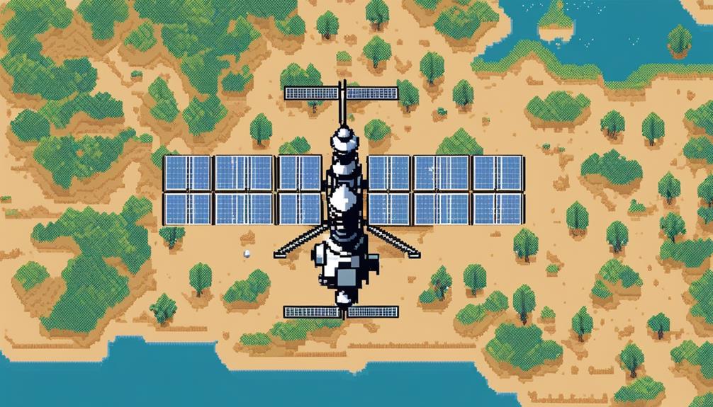
Satellites, with their vantage point from space, serve as indispensable tools in environmental monitoring, offering a comprehensive view of our planet's dynamic systems. Their ability to capture data on a global scale provides crucial insights into climate patterns, natural disasters, and ecosystem changes. By harnessing advanced technologies onboard these satellites, scientists can decipher intricate environmental processes and trends, aiding in informed decision-making for sustainable resource management. As we delve deeper into the intricate web of satellite applications, the intricate dance between technology and Earth's ecosystems unfolds, revealing a realm of possibilities that continues to shape our understanding of environmental dynamics.
Key Takeaways
- Satellite technology enables efficient real-time monitoring of environmental changes.
- Satellite data influences policies by providing accurate information for informed decisions.
- Precision agriculture benefits from satellite data for optimizing resource allocation and enhancing crop production.
- Collaboration and advancements in satellite technology contribute to effective environmental monitoring across various sectors.
Evolution of Satellite Technology
The evolution of satellite technology has profoundly transformed environmental monitoring practices by enabling a shift from manual data collection methods to near-real-time data acquisition capabilities. Satellites have become pivotal in monitoring environmental changes due to their high-resolution imagery and advanced sensors. This shift has revolutionized environmental monitoring, providing a comprehensive view of the planet's changes over time.
Satellites equipped with advanced sensors play a crucial role in monitoring environmental changes as they orbit the Earth, capturing high-resolution imagery that offers detailed information about various ecosystems. The data collected by these satellites provide valuable insights into the dynamics of environmental processes, such as deforestation, urban expansion, and natural disasters. By utilizing satellite technology, monitoring processes have become more efficient, cost-effective, and reliable.
One of the key advantages of satellite technology is the near-real-time data acquisition capabilities it offers. This means that environmental changes can be monitored and analyzed promptly, allowing for timely responses to emerging issues. The comprehensive view provided by satellites enables researchers and policymakers to make informed decisions based on up-to-date and accurate information. Overall, the evolution of satellite technology has significantly enhanced environmental monitoring practices, making it an indispensable tool in the field of environmental science.
Satellite Applications in Deforestation Tracking
Utilizing satellite technology for monitoring deforestation activities involves analyzing high-resolution imagery to track changes in forest cover and detect illegal logging practices. This method enables real-time monitoring of deforestation activities and provides valuable insights into land use changes. Satellite applications in deforestation tracking play a crucial role in environmental conservation efforts. Here are four key aspects highlighting the significance of satellite technology in monitoring deforestation:
- High-Resolution Imagery: Satellites offer high-resolution imagery that allows for detailed monitoring of forest areas, making it possible to detect even subtle changes in vegetation cover.
- Detection of Illegal Logging Activities: Satellite data aids in identifying illegal logging activities by analyzing patterns of forest disturbance, enabling authorities to take timely action to prevent further deforestation.
- Identification of Deforestation Hotspots: Remote sensing technology helps in pinpointing deforestation hotspots, areas where deforestation is most rampant, allowing for targeted conservation interventions.
- Monitoring Land Use Changes: Satellite monitoring facilitates the tracking of land use changes over time, providing valuable information for policymakers and researchers to understand the drivers of deforestation and implement effective conservation strategies.
Satellite Observations of Climate Change

Satellite observations play a pivotal role in monitoring and studying climate change phenomena, offering detailed insights into evolving climatic patterns on a global scale. Satellites continuously track various climate variables, enabling scientists to analyze changing climatic patterns and identify climate change hotspots worldwide. By providing detailed maps of these changes, satellite data helps in understanding the drivers and impacts of climate change on a large scale. One of the significant contributions of satellites is their ability to track temperature changes accurately, aiding in predicting future climate events with more precision. This data is crucial for informing policies and strategies aimed at addressing the challenges posed by climate change.
| Satellite Observations of Climate Change | |
|---|---|
| Climate Variables | Tracking various climate parameters in real-time |
| Changing Climatic Patterns | Analyzing and monitoring global climate change trends |
| Detailed Maps | Providing visual representation of climate change hotspots |
| Drivers of Climate Change | Understanding the factors contributing to climate change |
| Impacts of Climate Change | Assessing the effects of changing climate patterns |
Satellite Data in Disaster Management
Enhancing disaster response through advanced data analysis techniques has become increasingly reliant on satellite observations. Satellite data plays a pivotal role in disaster management by providing real-time monitoring and valuable insights into various natural calamities. Here are four key ways in which satellite data contributes to disaster management:
- Real-time Monitoring of Wildfires and Floods: Satellites offer real-time monitoring of wildfires globally, aiding in understanding their behavior and patterns. They also enable mapping and managing of floods in real-time, supporting the creation of predictive models for effective disaster response.
- Forecasting Heat Waves and Droughts: Satellite technology is instrumental in improving the understanding and forecasting of heat waves through real-time temperature data analysis. Moreover, satellites play a crucial role in predicting and monitoring droughts, assessing their impact on vegetation health and water availability.
- Monitoring Environmental Degradation: Utilizing satellite data enhances the monitoring of environmental degradation, including tracking deforestation trends, sea level rise, glacier melting, and greenhouse gas emissions contributing to climate change. This data is vital for assessing the impact of disasters on the environment and planning suitable mitigation strategies.
- Supporting Predictive Models for Disaster Management: By providing detailed and up-to-date information, satellite data supports the creation of predictive models that can help authorities prepare for disasters, allocate resources efficiently, and minimize the impact on communities and ecosystems.
Satellite Monitoring of Urban Development
Urban development monitoring through satellite observations involves the systematic tracking and analysis of changes in land use, infrastructure, and population density within cities. High-resolution satellite imagery plays a crucial role in capturing urban growth patterns, construction activities, and the expansion of built-up areas over time. This data is essential for city planners to assess the impact of infrastructure projects and make informed decisions for sustainable growth.
By utilizing satellite monitoring, urban planners can analyze trends such as deforestation, urban sprawl, and changes in green spaces within urban areas. This information is invaluable for managing resources effectively, mitigating environmental impacts, and enhancing urban planning strategies. Understanding population density shifts and land use changes through satellite data enables authorities to address issues related to urban development proactively.
Moreover, satellite monitoring of urban development provides insights into the effectiveness of past planning decisions, allowing for adjustments to be made for future projects. By monitoring these changes continuously, cities can strive towards more sustainable development practices and minimize adverse environmental impacts. Ultimately, the integration of satellite technology in urban planning processes enhances decision-making capabilities and fosters the creation of more resilient and environmentally conscious cities.
Satellite Impact on Environmental Policies
Satellite data plays a crucial role in influencing environmental policies by providing policymakers with accurate information for decision-making. The support from high-resolution satellite imagery enables effective monitoring of environmental changes, aiding in the development and implementation of regulations. Utilizing satellite observations, policymakers can address pressing environmental issues and work towards meeting international commitments related to climate change.
Policy Influence
The utilization of satellite data significantly shapes and informs environmental policies by providing crucial and timely information on key environmental indicators such as deforestation, air quality, and climate change.
- Satellite data aids in tracking illegal logging activities to enforce regulations protecting forests.
- Monitoring greenhouse gas emissions through satellites supports policy development to mitigate climate change.
- Real-time satellite data on air pollution levels guides policymakers in implementing measures to improve public health.
- Detailed insights from satellite observations empower governments to make informed decisions on environmental conservation and sustainable development initiatives.
Decision-Making Support
Effective environmental policies are significantly influenced by the utilization of satellite data, providing real-time monitoring and insights into key environmental indicators for informed decision-making. High-resolution satellite data plays a crucial role in supporting decision-making processes related to environmental policies. By offering real-time updates on changes in forests, oceans, and the atmosphere, monitoring satellites enable policymakers to track deforestation, glacier melt, and air pollution accurately. This data is instrumental in developing and implementing regulations concerning environmental issues like illegal logging, deforestation, and air quality control. Furthermore, satellite technology enhances the understanding of climate change impacts, natural disasters, and environmental degradation, providing comprehensive insights essential for shaping policies towards a sustainable future.
Satellite Data for Precision Agriculture
Satellite data plays a crucial role in precision agriculture by facilitating real-time monitoring of crop health and enabling predictive analysis of yield potential. This technology empowers farmers to make informed decisions regarding irrigation and nutrient management, ultimately enhancing crop production efficiency. By harnessing satellite data for precision agriculture, farmers can optimize resource allocation and implement targeted interventions to address agricultural challenges effectively.
Crop Health Monitoring
Utilizing advanced satellite data analysis techniques, precision agriculture is revolutionizing crop health monitoring by providing farmers with crucial insights into chlorophyll content and moisture levels for targeted interventions.
- Satellite data enables precise monitoring of crop health indicators such as chlorophyll content and moisture levels.
- Remote sensing from satellites offers detailed information on crop conditions, facilitating focused interventions for optimal growth.
- Satellite imagery aids in identifying areas affected by nutrient deficiency or pest infestation, allowing for efficient crop management strategies.
- Monitoring crop health through satellites can enhance yields, decrease input costs, and reduce environmental impact by enabling targeted interventions aligned with sustainable farming practices.
Yield Prediction Analysis
Enhancing agricultural practices through the integration of satellite data analysis, yield prediction analysis in precision agriculture leverages factors such as soil health, crop type, and weather conditions to optimize crop yield outcomes. By utilizing high-resolution imagery and monitoring crop growth stages, satellite data enables farmers to predict yields accurately and allocate resources efficiently. This targeted approach to farming not only enhances decision-making processes but also promotes optimal crop yield by identifying areas that may require specific interventions. Through the implementation of efficient farming practices supported by satellite data, farmers can minimize input waste and maximize productivity, ultimately leading to improved economic and environmental sustainability in agriculture.
Satellite Role in Biodiversity Conservation
By harnessing advanced satellite technology, comprehensive insights into biodiversity conservation efforts in mining areas can be achieved through monitoring changes in vegetation, land use, and biodiversity.
Key Points:
- Holistic View: Satellites capture vast areas, enabling a holistic view of the impact of mining activities on biodiversity conservation.
- Insights into Large Ecosystems: Satellite imaging offers detailed insights into large ecosystems, aiding in the conservation and protection of biodiversity.
- Informed Decision-Making: Monitoring technologies utilizing satellite data track changes in biodiversity, allowing for informed decision-making and sustainable practices.
- Detection of Ecological Impacts: Satellite technology plays a crucial role in detecting ecological impacts in mining areas and implementing effective conservation measures.
Satellite data allows for the continuous monitoring of changes in biodiversity, offering a real-time perspective on the effects of mining activities on the environment. By analyzing this data, conservationists and policymakers can develop strategies to mitigate negative impacts and promote sustainable practices. The ability to observe large ecosystems from a distance provides a unique advantage in identifying areas of high biodiversity that require protection. Furthermore, the detailed insights from satellite imaging help in understanding how changes in land use affect biodiversity, guiding conservation efforts towards preserving valuable habitats. In essence, satellites serve as indispensable tools in biodiversity conservation, offering a bird's eye view of ecosystems and facilitating proactive conservation measures.
Satellite Contribution to Hazard Identification
Satellite technology plays a crucial role in identifying and monitoring natural hazards, providing valuable real-time data for effective disaster management. Satellite data helps in hazard identification by providing high-resolution images that enable the monitoring of climate change, severe weather events, and environmental conditions. Through advanced sensors on satellites, changes in temperature, moisture levels, and other environmental parameters can be detected promptly, contributing to the early warning systems for severe weather events like hurricanes, wildfires, and floods.
The high-resolution satellite imagery assists in pinpointing hazard-prone areas and assessing potential risks, allowing for better disaster response planning. Moreover, satellites track changes in land use, vegetation health, and water bodies, enhancing hazard identification capabilities. This tracking of changes aids in understanding the evolving environmental landscape and potential risks associated with natural hazards.
Future Advancements in Satellite Monitoring
Future advancements in satellite monitoring will revolutionize environmental observation capabilities, ushering in a new era of precision and comprehensive data analysis. The following are key areas where these advancements will make a significant impact:
- Increased Resolution: Advancements in satellite technology will lead to higher-resolution imagery, allowing for more detailed monitoring of environmental changes such as deforestation, urban expansion, and natural disasters.
- Enhanced Data Integration: Integration with other technologies such as artificial intelligence and Internet of Things (IoT) devices will enable a more holistic approach to environmental monitoring. This integration will provide a comprehensive understanding of complex environmental systems and their interactions.
- Advanced Data Analysis: Improved data analysis tools, including machine learning algorithms and big data processing capabilities, will allow for the efficient processing of vast amounts of satellite data. This will facilitate the extraction of valuable insights and trends from the data for better decision-making.
- Global Collaboration: Better collaboration between researchers, governments, and organizations globally will result in more standardized monitoring practices and data sharing. This collaboration will lead to more accurate and comprehensive environmental monitoring on a global scale, addressing issues such as climate change, biodiversity loss, and natural resource management.
These advancements hold great promise for applications in precision agriculture management, disaster response, ecosystem conservation, and climate change mitigation.
Frequently Asked Questions
What Is the Role of Satellite in Environment?
Satellite technology revolutionizes environmental surveillance through remote sensing, enabling precise data collection for Earth observation. With global coverage, satellites facilitate geographic information analysis for effective resource management and pollution tracking. Their role extends beyond mere monitoring to active participation in environmental preservation and policy-making. By harnessing advanced technology, satellites serve as indispensable tools in safeguarding our planet's health and sustainability.
What Is the Role of Satellite Data in Monitoring Climate Change?
Satellite data plays a critical role in monitoring climate change by providing valuable insights into greenhouse gas emissions, temperature trends, deforestation rates, sea level rise, ocean acidification, ice melt, extreme weather events, biodiversity loss, and land use changes. This data enables scientists to track these indicators on a global scale, helping to understand the drivers and impacts of climate change more effectively. Satellite monitoring is instrumental in enhancing our knowledge of climate change phenomena and informing mitigation strategies.
How Have Satellites Been Used for Monitoring?
Satellites have been instrumental in monitoring various environmental aspects, facilitating advancements in water quality assessment, deforestation tracking, land use analysis, urban heat mapping, agricultural productivity evaluation, ocean health monitoring, air pollution detection, wildlife conservation efforts, and natural disaster management. Through high-resolution imagery and data collection, satellites aid in observing, analyzing, and addressing critical environmental challenges across different ecosystems and geographical regions, contributing significantly to sustainable environmental management practices.
How Does Satellite Imaging Help the Environment?
Satellite imaging significantly contributes to environmental protection by facilitating pollution detection, deforestation tracking, and other vital monitoring tasks. For instance, satellite data aids in identifying pollution sources, such as industrial emissions or oil spills, enabling swift response measures. Moreover, it assists in monitoring deforestation rates, identifying areas of concern for conservation efforts, and tracking changes in land use patterns. These capabilities underscore the critical role of satellite technology in safeguarding the environment.